Digital Cartography
 Drones offer the potential
for addressing several major challenges in agriculture.
With the world's population
projected to reach 9 billion people by 2050, experts
expect agricultural consumption
to increase by nearly 70 percent over the same
time period. Agricultural producers must embrace revoluonary
strategies for
producing food, increasing producvity,
and making sustainability a priority.
Drones are part of the solution,
along with closer collaboration
between
governments, technology leaders, and industry. Azdynamics team predicted the
future demands of goverment and offers E-Agriculture solutions
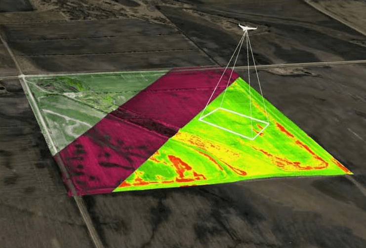
providing UAV
based precision mapping, thermal soil analysis and NDVI (Normalised Difference
Vegitaon
Index) vegitation
health analysis services in Azerbaijan. Our team of GIS
and mapping professionals along with our Yarasa series drones with very skilled
pilots can provide you with the best image quality ever seen on digital maps along
with cenmeter
level GPS accuracy.
Drones offer the potential
for addressing several major challenges in agriculture.
With the world's population
projected to reach 9 billion people by 2050, experts
expect agricultural consumption
to increase by nearly 70 percent over the same
time period. Agricultural producers must embrace revoluonary
strategies for
producing food, increasing producvity,
and making sustainability a priority.
Drones are part of the solution,
along with closer collaboration
between
governments, technology leaders, and industry. Azdynamics team predicted the
future demands of goverment and offers E-Agriculture solutions
providing UAV
based precision mapping, thermal soil analysis and NDVI (Normalised Difference
Vegitaon
Index) vegitation
health analysis services in Azerbaijan. Our team of GIS
and mapping professionals along with our Yarasa series drones with very skilled
pilots can provide you with the best image quality ever seen on digital maps along
with cenmeter
level GPS accuracy.